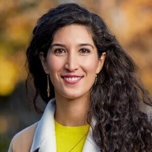
Partner Profile & New Science Advisor Intro | Dr. Raha Hakimdavar


This month, we’re excited to introduce a new Science Advisor to Blue Forest, Dr. Raha Hakimdavar, and to discuss her perspective on incorporating satellite-based Earth observations into environmental management decisions.
Written by: Jessica Alvarez, Communications & Content Manager
This month, we’re excited to introduce a new Science Advisor to Blue Forest, Dr. Raha Hakimdavar, and to discuss her perspective on incorporating satellite-based Earth observations into environmental management decisions. Dr. Hakimdavar was an amazing thought partner on using remote sensing to monitor nature’s benefits when she worked at the US Forest Service (USFS) Washington DC office, before taking on an exciting new role as Director of Space Sciences with Ball Aerospace. In her new role, she will focus more on technology development aspects to continue advancing our Earth-observing capabilities to meet critical science and decision-support needs.
“There is so much opportunity for satellite data to help us more effectively manage water and land resources that are under increasing threat from climate change”, said Dr. Hakimdavar as she described her efforts to revamp the USFS Watershed Condition Framework and quantify watershed restoration outcomes using remote sensing. While at the USFS, she led an interdisciplinary team of natural resource specialists and scientists that were tasked with updating the way that the agency prioritizes watershed restoration projects and measures effectiveness outcomes. This was part of an ongoing effort that will result in a revised framework by 2026. When asked about the challenges, Dr. Hakimdavar commented “working at the implementation scale, you constantly have to assess if new data sources are going to provide more timely, accurate, and cost-effective information than other standard approaches so that you can make the business case for adoption”, stressing that “rarely is data a stand-alone solution to solving complex ecological challenges but, if used in the right ways, it can help us prioritize investments, measure impacts from major stressors, and essentially evaluate the effectiveness of our actions on the ground.” This is especially important for landscapes under stress from climate change, which have experienced significant change following wildfires, droughts, and floods.
Her work also extended globally through the United Nations Environment Programme and NASA to explore the use of satellite data for national reporting on the Sustainable Development Goals (SDGs). The SDGs were developed in 2015 as part of a comprehensive global effort to end poverty, with a focus on measuring the progress of specific indicators for sustainable development over time. The 17 global goals provide a framework for regional improvement by 2030 across multiple themes including gender equality, sustainable cities and communities, and life on land. The outcomes from the project were shared in a recent publication, which investigated how Earth observations can be used to monitor aspects of SDG 6, the goal on Clean Water and Sanitation, across different geographies.
“The objective of our study was to understand how different open source satellite products were able to measure water-related ecosystems, like the extent of surface water bodies and mangroves or different water quality characteristics like total suspended solids”, said Dr. Hakimdavar. The study looked at monitoring data in seven countries: Cambodia, Jamaica, Peru, Philippines, Senegal, Uganda, and Zambia. Dr. Hakimdavar summed the results up, stating that “while initial results are promising, this study really showed us that we need to expand our sample size of seven countries to better address the question of variability between datasets, and that on-the-ground validation and country ownership is needed to evaluate the accuracy of the results for eventual adoption.”
Here at Blue Forest, we’re focused on leveraging effective remote sensing tools to evaluate and monitor benefits of landscape management and restoration – particularly on water resources. We look forward to continuing to work with Dr. Hakimdavar to better understand how we can incorporate tools like these into our Forest Resilience Bond projects.